
Meta description: GTA 6 fans can explore a detailed interactive Leonida map built from official footage, revealing how Vice City and surrounding regions may connect.
GTA 6 players still have to wait before they can drive across Leonida themselves, but an ambitious community project is already offering a detailed look at Rockstar Games’ enormous new setting.
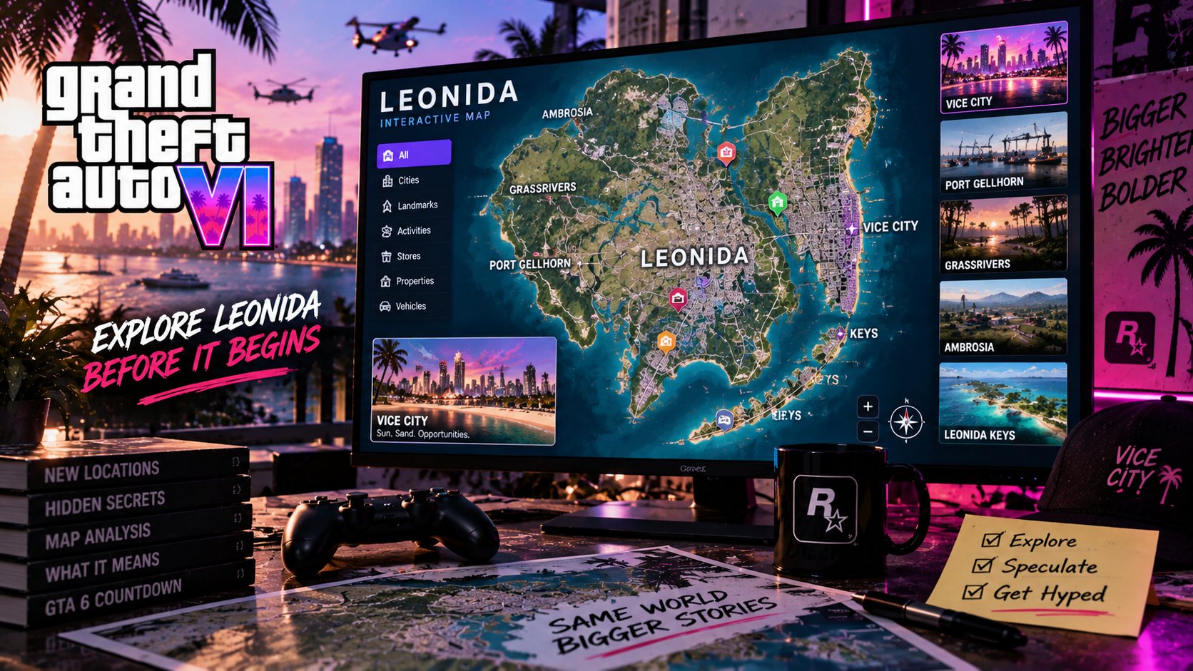
A fan-created GTA 6 interactive map brings together locations identified from Rockstar’s trailers, screenshots and promotional footage, allowing users to explore a reconstructed version of Leonida directly through a web browser.
The project is not an official Rockstar map, and many parts remain estimates. That distinction matters.
However, years of careful analysis have produced something far more sophisticated than a rough fan sketch. Roads, landmarks, districts and confirmed locations have been assembled into a navigable representation of the world players will eventually explore as Jason Duval and Lucia Caminos.
For anyone curious about the possible scale of GTA 6, it makes for fascinating viewing.
The GTA 6 Map Project Has Been Years in the Making
Fans began attempting to reconstruct GTA 6’s map long before Rockstar provided detailed information about Leonida.
The process relies heavily on visual evidence.
A highway sign visible for seconds in a trailer can reveal the direction of another location. Buildings can be compared across screenshots to determine camera positions. Bridges, coastlines, waterways and skylines provide additional reference points.
Even the position of the sun and distant landmarks can help establish how different locations may connect.
The result is essentially a large geographical puzzle.
As Rockstar releases more official material, incorrect assumptions can be removed and uncertain areas can be refined.
That means the community map continues evolving rather than representing a finished interpretation of Leonida.
Vice City Remains at the Heart of Leonida
The most recognizable location is naturally Vice City.
Rockstar’s modern version of the city takes heavy inspiration from Miami, combining beaches, high-rise buildings, nightlife districts, highways and residential neighborhoods.
Vice City appears considerably more detailed than the version players explored in 2002.
The city is no longer an isolated interpretation of Miami surrounded by relatively limited countryside. It now exists within a much larger fictional state.
The interactive map helps illustrate that difference.
Players can see how the dense urban center may connect with highways leading toward smaller communities, coastal regions and wilderness.
That broader geography could fundamentally change how Vice City feels.
The Leonida Keys Expand GTA 6 Beyond the City
South of the main urban area lies one of GTA 6’s most distinctive confirmed regions, the Leonida Keys.
The location is Rockstar’s interpretation of the Florida Keys, featuring tropical islands, long bridges, waterways and smaller communities.
Official screenshots have already shown Jason and Lucia around the region, while Rockstar describes it as an area where life is more relaxed but far from completely peaceful.
The Keys should also provide a natural playground for boats and other water-based activities.
That matters because GTA 6 appears to place considerably more emphasis on water than GTA V.
Rockstar has shown jet skis, boats, underwater exploration and marine environments. A long island chain gives those systems a practical role within the open world rather than treating the ocean merely as a boundary.
Grassrivers Brings Florida’s Wetlands Into GTA
Another major area is Grassrivers, Rockstar’s fictional interpretation of Florida’s famous wetlands.
The region provides a dramatic contrast with Vice City.
Instead of skyscrapers and crowded roads, players can expect marshland, waterways and wildlife.
Alligators have already become one of GTA 6’s most recognizable animals, appearing repeatedly throughout Rockstar’s promotional material.
The environment could also demonstrate how much Rockstar has carried forward from Red Dead Redemption 2.
That game placed considerable emphasis on wildlife behavior and natural ecosystems. Applying similar ideas to modern Leonida could make its rural areas feel far more alive than the countryside surrounding Los Santos in GTA V.
Port Gellhorn Shows a Rougher Side of Leonida
Rockstar has also introduced Port Gellhorn, a coastal location that appears far removed from Vice City’s polished tourist image.
The area is described as a faded vacation destination where cheap attractions and struggling businesses remain after better times have passed.
That makes it an interesting setting for GTA’s particular style of satire.
Grand Theft Auto worlds work best when wealthy districts sit alongside neglected areas and different communities have their own identities.
Port Gellhorn appears designed to provide exactly that contrast.
The fan map helps place the region within the wider state, although its exact boundaries and road network remain subject to change until Rockstar releases an official map.
Leonida Goes Further Inland Than Many Fans Expected
GTA 6 is not limited to beaches, islands and wetlands.
Ambrosia introduces an industrial side of the state, while Mount Kalaga National Park pushes players into a more rugged environment.
Mount Kalaga is particularly interesting because it expands the visual identity of Leonida beyond the flat landscapes commonly associated with Florida.
Rockstar describes the area as a place for hunting, fishing and off-road exploration.
That suggests GTA 6’s wilderness will serve a practical gameplay purpose rather than simply filling space between cities.
The range of confirmed regions also makes direct comparisons with GTA V’s map increasingly difficult.
Size alone does not tell the whole story.
The Interactive Map Should Not Be Mistaken for Rockstar’s Final Layout
As impressive as the project is, players should keep one limitation in mind.
This is a fan-made GTA 6 map.
Rockstar has confirmed numerous locations and shown many recognizable landmarks, but it has not publicly released the complete in-game map.
Sections of the interactive version therefore rely on interpretation and estimation.
Roads may eventually follow different routes. Distances between locations could change. Areas currently left relatively empty may contain towns or landmarks Rockstar has simply chosen not to reveal.
That uncertainty is part of what makes the project interesting.
Every new Rockstar screenshot has the potential to alter the map.
Rockstar Is Slowly Filling in the Blank Spaces
The amount of reliable information is increasing quickly as launch approaches.
Rockstar has revealed more of Leonida through its Extended Look, official screenshots and character profiles. Additional media coverage and developer interviews are also providing new context around how the world was created.
For the mapping community, every reveal provides another set of clues.
Eventually, of course, all of this detective work will become unnecessary.
Players will be able to open GTA 6’s actual map, place a waypoint and drive across Leonida themselves.
Until then, the interactive project offers one of the clearest ways to appreciate the possible scale and variety of Rockstar’s new world.
It also demonstrates something unusual about GTA 6’s long development cycle.
Fans have spent years exploring a place they technically cannot visit yet.
When Grand Theft Auto VI launches on November 19, 2026 for PlayStation 5 and Xbox Series X|S, one of the first things many players will probably do is compare Rockstar’s finished Leonida with the map the community spent years trying to reconstruct.